
Stops & Shops
Partners


History of the Turquoise Trail
The Turquoise Trail Today
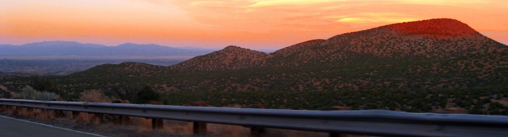
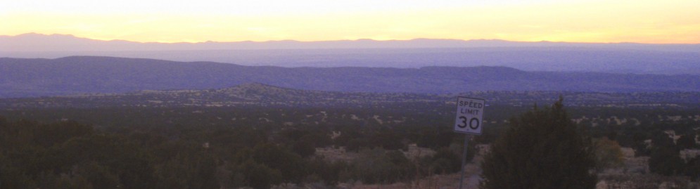
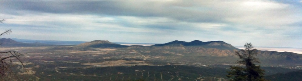
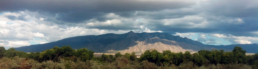
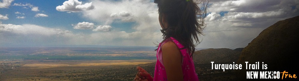
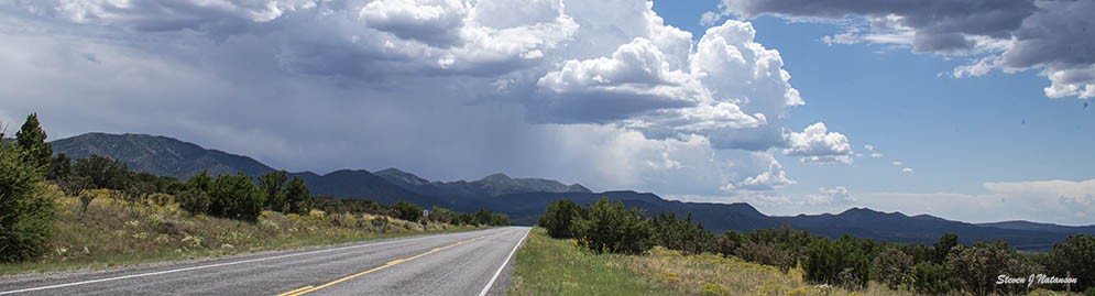
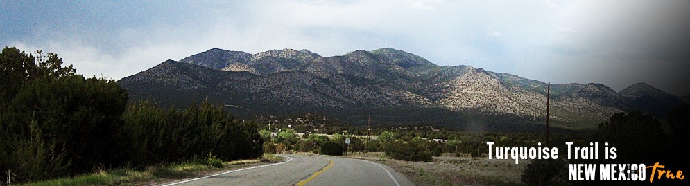
The Turquoise Trail encompasses 15,000 square miles and is located in the heart of central New Mexico. We link Albuquerque and Santa Fe and sit at our highest peak at 10,600 feet (Sandia Crest) overlooking Albuquerque and the Rio Grande Valley.
Our name comes from the blue-green turquoise first mined by the early Pueblo people, an agrarian based society dwelling along the Rio Grande as early as 900 A.D. The stone has become nationally recognized as a precious stone to be set in silver and gold. The Spanish arrived here as early as the 1500s. Francisco Vazquez de Coronado was the first of many explorers in New Mexico. Missionaries, Spanish settlers and Anglo-Americans all followed and joined the native American Indians already here. Today the National Scenic Byway is home to many modern day settlers and host to tens of thousands of visitors a year!
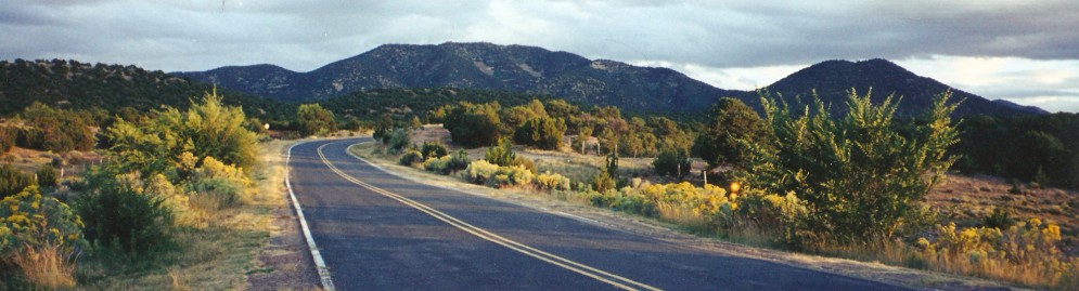
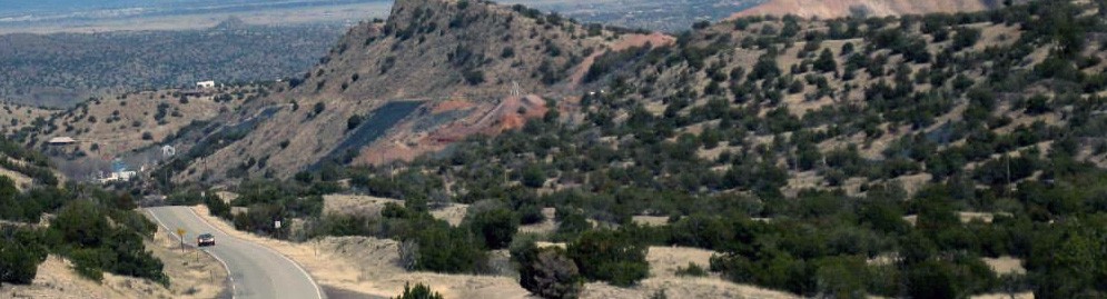
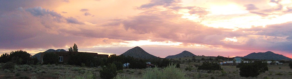
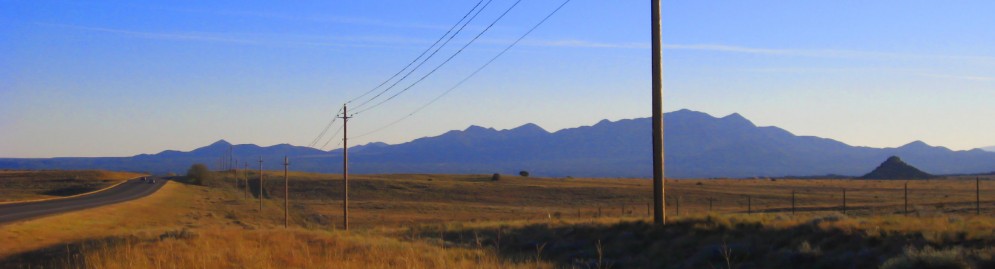
The Trail begins to the South in Tijeras and the Cibola National Forest, then heads north through San Antonio, Cedar Crest, Sandia Park, Edgewood, Golden, Madrid, and Cerrillos, before ending above the San Marcos/Lone Butte Area. Along the 65 miles are homes, ranches, museums, restaurants, RV parks, vacation lodging, a golf course, a ski resort, horseback riding stables, shops, galleries and lots of respected craftsmen and artists. The Trail is also known for its adventurous hiking and bike trails. In spite of the recent growth to the area, The Turquoise Trail remains historically quaint and Old West. Much of the effort to maintain the beauty and history of the area is due to the efforts of The Turquoise Trail Association who promote the Turquoise Trail as the scenic way to Santa Fe, and who applied for and received our National Scenic Byway status. In 2000, the Turquoise Trail was one of nationally designated “Scenic Byways” in America. A designation to be coveted!
Share The History
The Turquoise Trail is synonymous with Native American lifeways, Spanish explorers and settlers, adventurous mining, and brave pioneers. A major Western gold rush occurred here around 1825, years before the California Gold Rush. But Cerrillos, (the little hills) was coveted long before the search for gold for its rich deposits of turquoise, as well as lead ores, used to glaze and decorate traditional Rio Grande pottery. The Cerrillos hills encompasses three cultures and the longest intact record of historic stone maul and pick and shovel mining in the Southwest. Golden rapidly grew into a substantial town in the early to mid-1800s and received its name from the discovery of its placer gold deposits in 1840.The area was originally two smaller settlements named El Real de San Francisco and Puerto. Madrid was mined by squatters in the early 1800s and later became a substantial company-owned coal mining town, with a population of over 3,000 (some say it may have been as high as 4,000 residents). And there is much more to know and tell…
Here’s a brief overview and history of the cities of The Turquoise Trail:
Tijeras
Tijeras is the southern gateway to The Turquoise Trail and home to one of the Cibola National Forest’s Visitor Centers. The forest spans three states and almost 2 million acres. In Tijeras, the Sandia Ranger Station is open weekdays with visitor information. The Tijeras gateway is open year round and hosts more visitors than any mountain area in New Mexico. It is also home to 200 families.
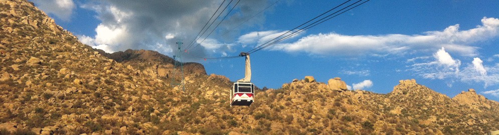
The Cibola Forest actively protects and manages wildlife, fish and rare plants and is the site of the Tijeras Pueblo Archaeological Site. Visitors can enjoy the world’s longest tramway—2.7 miles with an 11,000 square mile panoramic view and the 13-mile Sandia Crest Highway near the Sandia Wilderness—a National Byway within The Turquoise Trail National Scenic Byway. The forest also is host to Native American ceremonies, which began as early as 10,000 B.C. by the Clovis Pateo Indians and continues with today’s Indian inhabitants.
The Tijeras Pueblo, once a canyon community, was formed about A.D.1313. The village began with sand and clay walls to form the adobe and eventually housed up to 400 people. The drought in the region led to population migration. As water became scarce along the Rio Grande valley, families moved upland where rainfall was still abundant. The inhabitants cultivated maize beside the native pinon and juniper. The inhabitants were centrally connected with other villages by trading goods such as malachite and salt. Today the pueblo is a grass-covered mound where once stood a 200-room pueblo.
Cedar Crest
Cedar Crest was named in 1924 when Carl Webb moved the Tijeras Post Office from the Canyon Store to his Cedar Crest Resort. A lovely and mostly residential community, Cedar Crest has a population of just under 1,000 people. Shops, lodging and eateries provide services for visitors and residents to this community.
Sandia Park
Just up the road from Cedar Crest lies Sandia Park and the Sandia Mountains, filled with year-round outdoor activities and scenic driving. This is a wonderful spot to experience the ecological system of the area. In 1961 The National Parks Service designated Sandia Cave a National Historic Landmark. Its significance as a paleo-american site, since excavations there have yielded information on three distinct prehistoric groups. Located in Cibola National Forest, the site represents one of the earliest known occupations of the Americas.
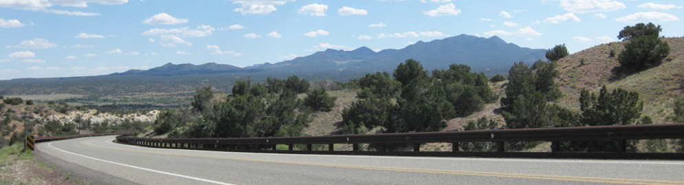
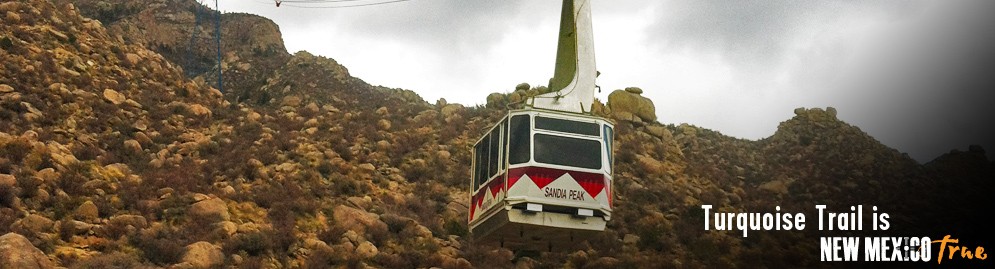
Today, bicycling, hiking, horseback riding, climbing and skiing are all enjoyed here, as well as bird watching. Visitors from around the world witness the hawk and eagle migrations in these mountains. The highest point of the mountains is 10,678 feet and can be enjoyed by taking a 13 mile drive to the top of Sandia Crest via NM 536. Amazing vistas at 10,300 feet can also be found by accessing the Sandia Peak Tramway, the world’s longest jig back tram, which means one car is going up while another is coming back. More than 275,000 people each year enjoy the spectacular views offered by the tramway!
The Sandia Crest National Scenic Byway winds through the beautiful Cibola National Forest. Drivers see incredible vistas and pass through five different life zones culminated with 360 degree views from the observation deck at the top. The Sandia Peak Ski area offers snowboarding and downhill skiing with six lifts. Summer visitors can hike and mountain bike down over 15 miles of trails.
Tinkertown Museum, which began as a hobby and passion of the late artist Ross J. Ward, is located on the Crest Road. It offers amazing animated miniature of Old West Town and circus relics, among thousands of hand-carved figures. The surrounding community hosts shops and eateries, many with outdoor seating and other local services.
Golden
The settlement we now call Golden was established in 1879. The Post Office, which was the first to name the community Golden was opened in 1880. There are known remnants of two pueblos in the area dating to the 1300's.
A gold boom drew individual prospectors and small operators and lasted until the 1880s. Due to limited gold finds; however, the rush did not last, but ranching has continued in the area. The San Francisco Catholic Church is one of the most photographed buildings along the Trail. It is an attractive adobe building that dates back to 1830 and was restored by historian and author Fray Angelico Chavez, during his tenure as padre of the San Jose in Cerrillos in the 1960s. The church has mass on Saturdays at 4:00 pm. The ruins of the town’s stone schoolhouse lie to the west of the church.
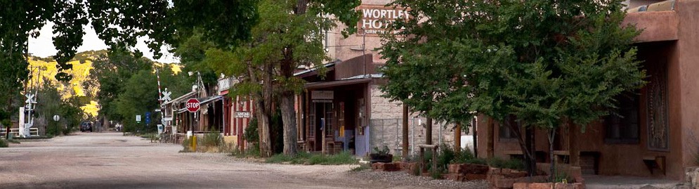
Madrid
Madrid sits midway along The Turquoise Trail and has a colorful history, dating to the early 1800’s when squatters arrived and mined the area. General Stephen Kearny sent troops to the area for fuel to build Fort Marcy, during the occupation of Santa Fe in 1846. As coal became an important resource, the Santa Fe railroad brought a spur to Madrid in 1892. Sitting on 30 square miles of hard and soft coal with a network of tunnels that made up the Lucas & White Ash, the Peacock and the 2,500-foot Cooke mines. At its height over 3,000 people lived and work in Madrid.
At its peak the town produced 250,000 tons of coal a year and boasted a population exceeding Albuquerque. Oscar Huber, who worked for the coal company, became superintendent in 1918 and later gained controlling interest, after the original owner George Caseman was killed in a drilling accident in 1936. Under Huber, Madrid residents enjoyed a hospital, paved streets and unlimited electricity in their homes. The Mineshaft Tavern which burned to the ground on Christmas Day 1944, was rebuilt. The pine and oak bar is still known as the “longest bar in the state.” Huber also built the first illuminated baseball park west of the Mississippi. The lights were turned on in 1922 putting Madrid in the history books. The stadium was home to the Madrid Miners, a farm team for the Brooklyn Dodgers and the Dodgers even played a game in the park to a packed house in 1934. The Oscar Huber Memorial Ballpark is one of the last standing Minor League Ballpark of its kind in the United States and holds events throughout the year.
Madrid is known for its annual Christmas lighting display, which began in the 1920s. New Mexican families from many miles away made the long trek to see the elaborate displays of lights and nativity scenes. In the early 20th century the electric plant was owned by the town’s coal company and Madrid had the luxury of unlimited electricity for the displays. Then local resident Paul Lanz, whose brother was an employee of Walt Disney, probably had a connection to the light displays! Trans America Airways—later known as TWA—diverted nighttime flights over Madrid to allow passengers to see the spectacle.
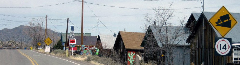
When the coal market collapsed, so did Madrid’s infrastructure. Eventually the town’s residents moved away and Madrid became a ghost town. In 1954 the Wall Street Journal listed the entire town for sale for $250,000. By the 1960’s and 70’s an array of artists, crafts people and renegades rediscovered Madrid. Eventually the town’s abandoned Victorian homes and clapboard storefronts were sold and new populations began to form in the town. Today Madrid pioneers make up about 400 residents—local artists, craftspeople, gallery owners and business commuters to Santa Fe. The Holiday lighting display is back and shops, food establishments and lodging facilities operate year-round with several annual events that attract local and not-so local visitors.
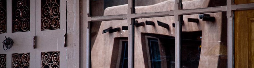
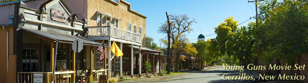
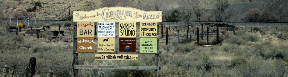
Cerrillos
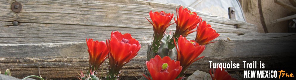
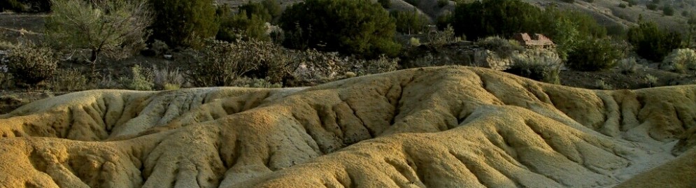
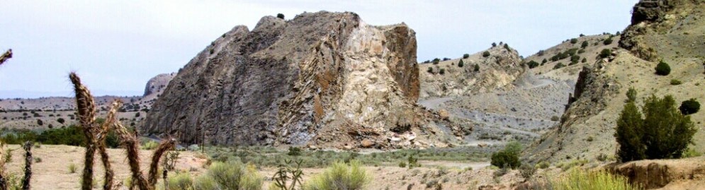
Cerrillos is best known for the rare blue-green turquoise named after the town. Mined in the Cerrillos hills as early as 900 AD, the town is one of the oldest historically documented mining districts in the United States. The rich deposits of turquoise in the Cerrillos hills at 12 different sites later impacted the awareness, uses and value of the stone in the U.S. and around the world. The Indian word “chalchihuitl” taken from an Aztec word meaning “green” became the name of the one of the Cerrillos hills exhibiting the largest source of turquoise. The hills are a distinctive cone shape rising 1,000 feet above the valley floor; formed from ancient volcanoes. Archaeologists have discovered turquoise specimens from cultural sites as far away as Central America, Canada and the Southeastern U.S., which they believe originated from Cerrillos. Along with the Native Americans who mined the stone, Spanish settlers arrived in the early 1600s and began mining silver and lead in the Cerrillos area. They established the El Real de Los Cerrillos camp, which lasted about a year; however, they did appoint a mayor, Alfonso Real de Aguilar who organized the mining. Fifty years of sometimes violent coexistence and mining ended in 1680 with the Pueblo Revolt of that same year. Scattered mining continued through the 1700s, but fell second to the discovery of gold in 1822 in the Ortiz Mountains. It wasn’t until after New Mexico became a territory Anglo mines brought new life to gold, silver and lead mines. With this new boom, Los Cerrillos “the little hills,” grew to a population of over 2,000, with four hotels and 21 saloons. The town was even considered to be the capital of New Mexico!
The rail road arrived in 1880, bringing many more people to the area, including some of the most notorious like “Billy the Kid.” In 1879 Major D.C. Hyde, the president of a gold and silver mining company, arrived on the scene and began promoting turquoise and underground “Wonder Caves,” luring the first tourists to the area. He mysteriously disappeared the next year. Tiffany & Co. as well as other New York jewelry companies, then began marketing turquoise as a fashionable gem. Tiffany & Co. even acquired property at Turquoise Hill and began mining the stone for their jewelry sales. The boom for turquoise jewelry continued until the 1900’s. As automobile tourism grew so did the interest in turquoise jewelry set in silver; however, most of the turquoise was then mined from other sites in the West and from foreign sources. There are several working Turquoise claims in the Cerrillos Mining District and rough, polished and finished jewelry can be found in area shops. A visit to the Cerrillos Turquoise Mining Museum features local Turquoise samples, photo's, diaorama's and other notable historic items.
The Cerrillos historic mining district is now a new State Park incorporating 1,100 acres. This exciting new public park with marked trails tells the story of mining along The Turquoise Trail. The community of Cerrillos continues to exude the charm and simplicity of the Old West, nestled among giant cottonwood trees, the streets remain mostly dirt, with adobe homes and Spanish-style courtyards. Because of the 1800s feel, the town is often used for filming movies and commercials. Visitors can enjoy the Casa Grande Trading Post, Cerrillos Turquoise Mining Museum and petting zoo, Broken Saddle stable, the Blackbird Saloon and a shop and gallery on First Street. Cerrillos Hills State Park has just over 5-miles of hiking, horseback riding and biking trails. The hanging tree, Saint Joseph’s church and shrine are major attractions for photo buffs. The church is active in the community and offers mass on Sundays. Above Cerrillos, sits the Ortiz Mountains and what may be among the first significant gold mines west of the Mississippi.
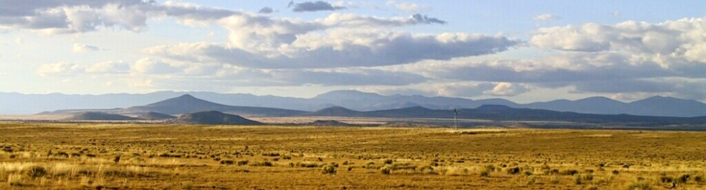
Lone Butte/San Marcos
The Galisteo Basin in the 1300s and 1400s had a very large Pueblo population, possibly more people than are living here today (including Eldorado!). When Diego De Vargas returned to New Mexico in 1692 after the Pueblo Revolt, the entire basin was effectively deserted. Galisteo village was founded 15 years later. This area is easily recognized for the razor-back rock formations that stretch along the Trail from Los Cerrillos to the Galisteo turn-off. The formations are named “Garden of the Gods”. Now a residential and service area for The Turquoise Trail, visitors will find several galleries and restaurants. Area movie ranches have been home to hundreds of movies and hold seasonal artist fairs and music festivals. The drive along the northern end of the Trail offers views of the Sangre de Cristo Mountains, open ranges of antelope and even buffalo. Just North of Lone Butte/San Marcos travelers reach the end of the Trail, where it meets historic Route 66 and Santa Fe.
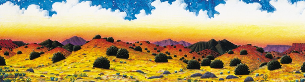
The Turquoise Trail Eco-System
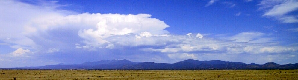
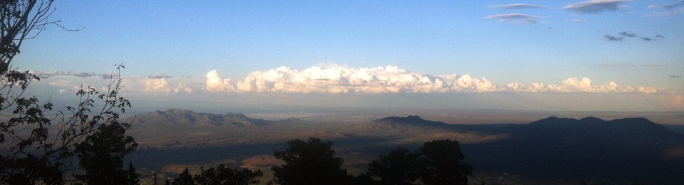
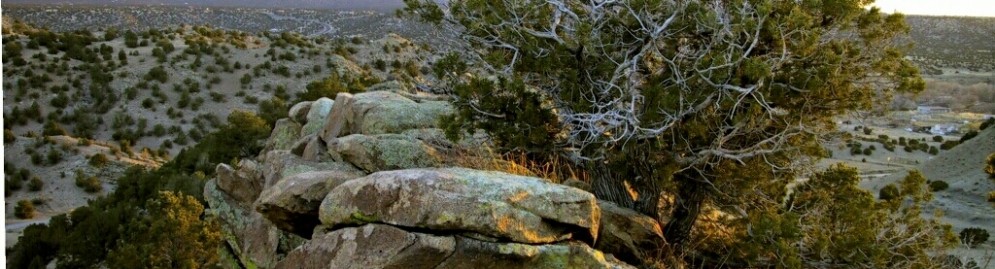
The Trail begins above the high Chihuahuan Desert and incorporates plateaus, hills and mountain areas, reaching as high at 10,600 feet above sea level in the Sandia Mountains. This high desert terrain overlooks Albuquerque and the Rio Grande Valley and stretches up to the southern end of Santa Fe. Vegetation is typical of the “pygmy forest” and includes pinon, juniper and some mountain mahogany. In the lower areas and arroyo bottoms are chamiso, Gamble oak, wavy leaf oak, Apache plume, New Mexico Olive, four-wing saltbush, and wafer ash, among other vegetation. Higher elevations support ponderosa pines and white firs.
Wildlife abounds along The Turquoise Trail and the area is a haven for birdwatchers! Bear, coyotes, mountain lions and much more join with numerous types of bird life, including owls, hawks and eagles. In the summer a wide variety of hummingbirds join the wildlife community.
Additional Information Source
https://eastmountainhistory.org
http://www.byways.org
http://www.cerrilloshills.org
http://www.nmparks.com
Construction Alert
Details about roadway construction on NM 14Upcoming Event
CrawDaddy Blues Festival
Saturday, May 17 & Sunday May 18, 2025The Mine Shaft Tavern in Madrid holds its Annual CrawDaddy Blues Festival. Great lively Blues!
Event details » View all events »
National Scenic Byway
The plan is available for review here »